


VTD-precinct 3, Faulk County, South Dakota
About
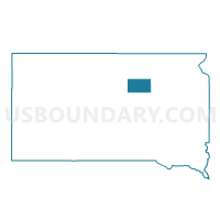
Outline

Summary
| Unique Area Identifier | 667296 |
| Name | VTD-precinct 3 |
| County | Faulk County |
| State | South Dakota |
| Area (square miles) | 288.48 |
| Land Area (square miles) | 280.07 |
| Water Area (square miles) | 8.41 |
| % of Land Area | 97.09 |
| % of Water Area | 2.91 |
| Latitude of the Internal Point | 45.09501090 |
| Longtitude of the Internal Point | -99.37926260 |
Maps


Graphs
Select a template below for downloading or customizing gragh for VTD-precinct 3, Faulk County, South Dakota


Neighbors
Neighoring Voting District (by Name) Neighboring Voting District on the Map
- VTD-precinct 2 Entprs-Frdom-Emrson-Sartga-Pulsk-MyrnTwp, Faulk County, SD
- VTD-precinct 25, Potter County, SD
- VTD-precinct 3, Hyde County, SD
- VTD-precinct 36, Potter County, SD
- VTD-precinct 4 Irving-Orient-ArcadeTwp-OrientTown, Faulk County, SD
- VTD-precinct 4 Mont-Hillside-Vermont-LibertyTwp, Edmunds County, SD
- VTD-precinct 6 Bryant-Tamworth-LafonTwp, Faulk County, SD
- VTD-precinct 7 -Modena-Bowdle-Odessa-Hudson-MadisonTwp-BowdleCity, Edmunds County, SD
Top 10 Neighboring County Subdivision (by Population) Neighboring County Subdivision on the Map
- East Potter UT, Potter County, SD (235)
- Saratoga township, Faulk County, SD (150)
- Enterprise township, Faulk County, SD (139)
- North Hyde UT, Hyde County, SD (115)
- Southwest Faulk UT, Faulk County, SD (56)
- Seneca town, Faulk County, SD (38)
- Sherman township, Faulk County, SD (36)
- Ellisville township, Faulk County, SD (36)
- Vermont township, Edmunds County, SD (35)
- Hillside township, Edmunds County, SD (32)
Top 10 Neighboring Place (by Population) Neighboring Place on the Map
Top 10 Neighboring Unified School District (by Population) Neighboring Unified School District on the Map
- Faulkton School District 24-4, SD (2,112)
- Highmore-Harrold School District 34-2, SD (1,821)
- Hoven School District 53-2, SD (1,127)
- Edmunds Central School District 22-5, SD (1,021)
- Bowdle School District 22-1, SD (758)
Top 10 Neighboring State Legislative District Lower Chamber (by Population) Neighboring State Legislative District Lower Chamber on the Map
Top 10 Neighboring State Legislative District Upper Chamber (by Population) Neighboring State Legislative District Upper Chamber on the Map
Top 10 Neighboring 111th Congressional District (by Population) Neighboring 111th Congressional District on the Map
Top 10 Neighboring Census Tract (by Population) Neighboring Census Tract on the Map
- Census Tract 9611, Faulk County, SD (2,364)
- Census Tract 1, Potter County, SD (2,329)
- Census Tract 9622, Edmunds County, SD (1,660)
- Census Tract 9767, Hyde County, SD (1,420)